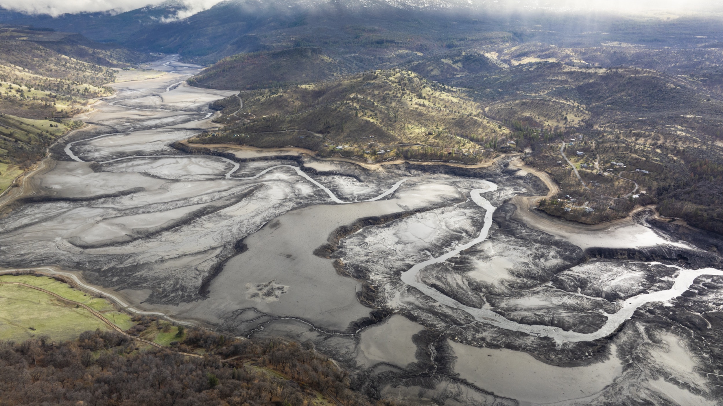
This article is also available in audio format. Listen now, download, or subscribe to “Hakai Magazine Audio Edition” through your favorite podcast app.
It’s a blustery November day, and I’m standing in a roadside pullout in Northern California, looking at the past and future of the Klamath River.
Immediately upstream I see Iron Gate Dam—17 stories tall, nearly four times as wide— completely blocking its red-rock canyon. There are four such dams, with Iron Gate as the first and largest, in 60 kilometers of river rising to the northeast. It’s a stretch sometimes called Reservoir Reach, and it has shut salmon out of hundreds of kilometers of potential habitat in the Upper Klamath Basin for more than a century.
The dams are the river’s past.
A reckoning
Share
By October of 2024, the four dams in Reservoir Reach will be gone.
The river will be finding its old channel, while restoration crews bring the once blocked and flooded land back to life.
Video: From the Iron Gate Dam site, the Klamath River flows for 300 kilometers to the Pacific Ocean. First photo: The Iron Gate Dam—the last component of the Klamath Hydroelectric Project—was opened with a dedication ceremony on February 3, 1962. Second and third photos: The Iron Gate Dam site before and after dam removal. Video by Shane Anderson/Swiftwater Films. Photos courtesy of the Klamath County Museum and Swiftwater Films
I’ve come to the Klamath to see what it looks like before that transformation begins. For two days, I’ve driven—sometimes on roads rough enough to invalidate my rental car insurance—through the site of the world’s largest dam-removal project. I’ve toured dams with representatives of the Klamath River Renewal Corporation (KRRC), the nonprofit body formed to drain the reservoirs and demolish the dams, and Resource Environmental Solutions (RES), the company hired to then restore the formerly flooded lands to a natural condition.
Above Iron Gate Dam, I saw Iron Gate Reservoir, its 66 million tonnes of water enough to fill so many railway tank cars that they could stretch across 14 time zones. The unnatural lake, created over 60 years ago, sprawls nine kilometers upstream, nearly to the next dam complex up the line. That site hosts a pair of barriers, Copco No. 1 and No. 2, that take their names from the California Oregon Power Company that built them, beginning 112 years ago. I’m already too late to see Copco No. 2. Just 10 meters tall, it was torn down by KRRC in the summer of 2023 as the first act of dam removal.
Copco No. 1 is stepped like a grand Mayan pyramid and is just as high. Behind it sits Copco Lake, another large reservoir. Above that, the river briefly runs wild through some 35 kilometers of remote canyon that crosses the border into Oregon and ends at John C. Boyle Dam, the last barrier in the chain. To produce hydropower, this small dam can redirect most of the river into a canal and powerhouse before releasing it back into the natural riverbed. This means that, immediately below John C. Boyle, seven kilometers of riverbed often holds hardly any river; the day I visit, it’s ankle-deep between boulders greasy with electric-green pond scum. A crick, as the locals would say.
When Copco, the company, first started damming the Klamath, bringing hydroelectric power to a remote corner of California was a higher priority for government and industry than the passage of fish up and down from the river’s headwaters in southern Oregon to the sea. Today, scientists count damming alongside overfishing, hatcheries, degraded habitat, and climate change as the biggest blows to what were once the third-largest salmon runs in the lower 48 states.
Dam proponents also ignored Native American rights and interests. Their projects’ reservoirs flooded homelands of the Shasta people, so utterly dispossessing them that they are not currently a federally recognized tribe. The Klamath Tribes, upstream of Reservoir Reach, and Karuk Tribe and Yurok Tribe, downstream, have led the two-decade campaign to see the dams eliminated and salmon and other river fish restored, joining forces with conservationists.
Tear down the dams, bring back the river: to me, an outsider, there doesn’t seem to be much not to like. The local economy, for example, is not on the line. Two small towns are most directly affected: Hornbrook, just downstream from Iron Gate Dam, has a population of 650 if you include the surrounding district; the cottage community of Copco Lake, on the Copco reservoir, has 120 residents, not all of them full-time. According to PacifiCorp, the Oregon-based company that owns the Klamath dams today, the structures are mainly monitored and controlled remotely—from Lewis River, Washington, more than 500 kilometers away. Local jobs add up to 13, and all the affected employees either retired, voluntarily left the company, or will be reassigned within it.
There’s perennial conflict over how much Klamath water should go to agriculture and other uses and how much to fish. But that battle is centered upstream, in Klamath Falls, Oregon, where a pair of dams will remain standing. (Technically, these are also part of Reservoir Reach; geographically, they stand in a distinctly gentler, more open landscape. Both are equipped to allow fish to pass.) The four dams slated for removal don’t hold water for irrigation.
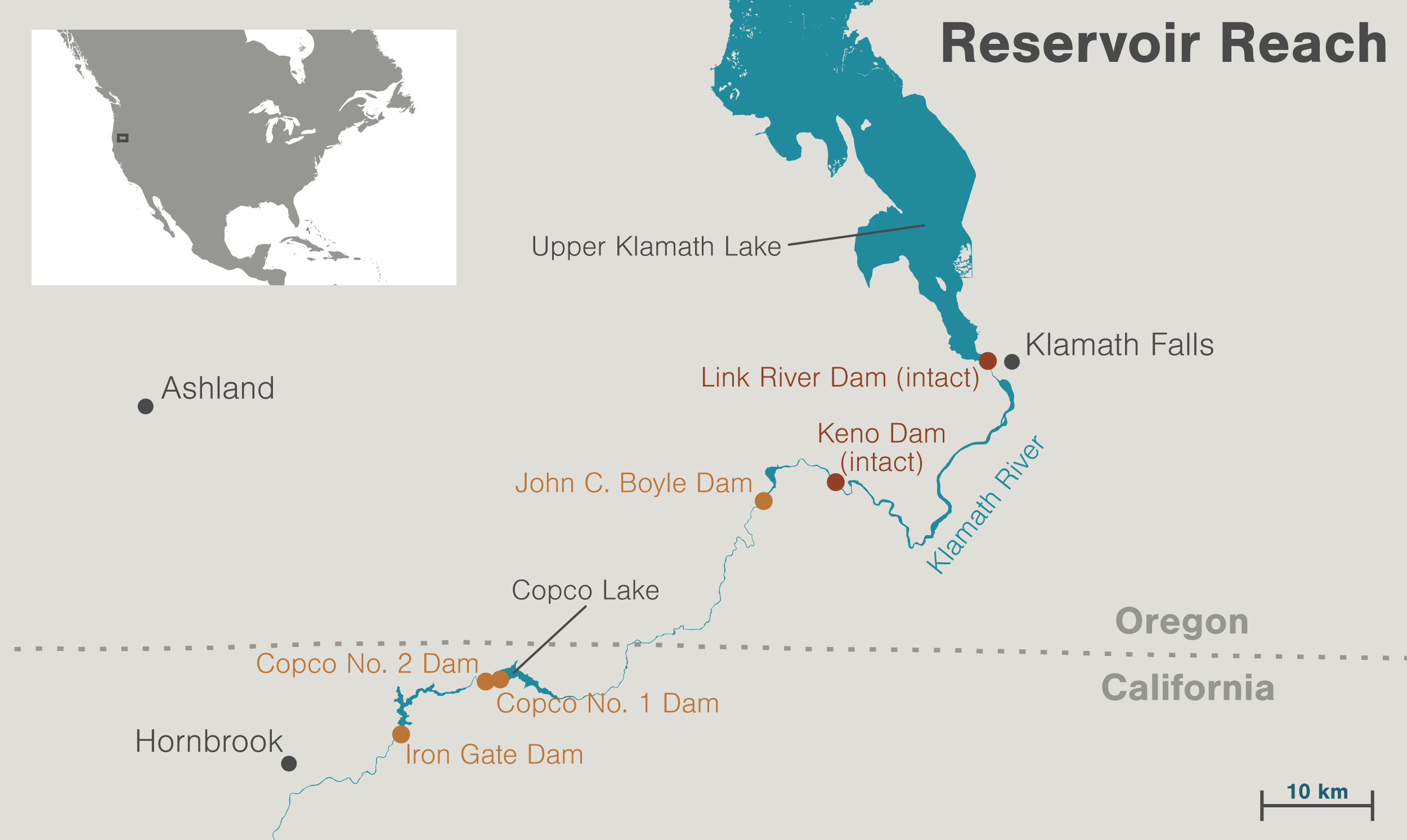
The stretch of the Klamath River known as Reservoir Reach extends from Iron Gate Dam in California to Klamath Falls, Oregon, 100 kilometers upstream. The two uppermost dams are equipped with fish ladders and will remain in place. Map by Mark Garrison with data from ArcGIS
The dams do produce enough hydropower to serve 70,000 households, so PacifiCorp will have to draw on the rest of its grid to replace that electricity. Still, the energy involved is less than 1.5 percent of PacifiCorp’s supply, which is steadily getting greener thanks mainly to wind and solar power. Since 2010, only 15 percent of the new electricity they’ve brought online has come from fossil-fuel burning.
Still, Dave Meurer, a spokesperson for RES who used to do the same job for KRRC, explains that most residents of Reservoir Reach are dead set against dam removal. That’s not surprising: people facing change and uncertainty frequently challenge and resist it. What does surprise me is learning that many locals fear the project—for some, it’s a “white-knuckle fear,” says Meurer. Later, Ren Brownell, the current director of community affairs for KRRC, mentions that when she stepped into her job in June 2023, death threats started rolling in immediately.
Resistance to dam removal on the Klamath is emblematic of the profound mistrust of official narratives that increasingly leads to such upside-down outcomes as survivors of climate disasters denying climate change, or rural communities accusing the wildfire fighters who protect their homes of deliberately setting the fires. Reservoir Reach is a place where, if KRRC is using helicopters to prep for dam removal, it must make sure the public knows that the choppers aren’t carrying out black ops against American sovereignty on behalf of the United Nations.
I didn’t come to Reservoir Reach to try to understand local opposition to dam removal, but perhaps I should have expected how much it would dominate my experience.
2. Oddness is not the whole story
In 2010, Siskiyou County in California—where three of the four Klamath River dams slated for demolition are found—voted almost 80 percent against removing them in a non-binding ballot initiative.
In Reservoir Reach today, the figure seems almost certainly higher.
The earth-filled Iron Gate Dam stands17 stories tall and is nearly four times as wide. Photo by Jason Hartwick/Swiftwater Films
And so, a month and a half after my first visit, I’m sitting among stately antiques at the home of Rex Cozzalio, a prominent critic of dam removal who lives just downstream of Iron Gate Dam, not far from Hornbrook. Cozzalio wears short-sleeve coveralls over a collared shirt, giving him the aspect of a gentleman farmer. I’ve taken a long and winding road to his doorstep, media-wary residents passing me from person to person until one finally arranged this meeting.
It comes at a sensitive time. At 9:30 a.m. the previous day, KRRC had, in effect, pulled the plug on Iron Gate Reservoir. A technician opened wide a hidden gate in a tunnel at the base of the dam. Moments later, a surge of water, chocolate brown with silt and sand, rushed forth with such power that boulders suddenly clunked and rumbled in the roaring river channel. Draw down the reservoir behind Iron Gate, and the dam’s demolition becomes, as one engineer puts it, “a labor, diesel, and yellow-iron project”—hard-hat crews and brightly painted machinery will break up the structure and cart it away. Iron Gate Reservoir (known locally as Iron Gate Lake) is draining as Cozzalio speaks.
And speak he does, nearly nonstop for three hours, with a tone of eye-rolling weariness at a world gone mad. He opposes dam removal at every level from the threat he feels it represents to his personal access to river water through to the project’s alleged role in a global conspiracy that threatens human life and liberty. As one of Cozzalio’s friends would later say, “Once he gets started, you just have to hang on.”
Cozzalio is influential locally in part, surely, because he verbally overwhelms his listeners, but mainly because he trades not in opinion—everybody has one—but facts. To sustain their objection to dam removal through the years, critics have needed to believe that the truth is on their side. The complexity of the issue has helped. As we’ve seen with climate and vaccine science, factual complexity leaves room for interpretation, and, to borrow the phrase made popular by vaccine skeptics, Cozzalio has “done his own research.” His arguments are convincingly detailed, and it would take a team of professionals to check the accuracy of all that he says.
To see how thorny those claims can be, we might take a look at one make-or-break example of where Cozzalio has shaped opinion: the question of whether, before dams were built, salmon really did spawn in the upper reaches of the Klamath River system. If so, then scrapping the dams will give the fish access to nearly 700 kilometers of former habitat. If not, then the project probably won’t do much to help salmon recover.
The Klamath’s chinook salmon are at historic lows, while naturally spawned coho are so depleted that they’re listed as threatened under the federal Endangered Species Act. According to Tommy Williams, a fish research biologist with the National Oceanic and Atmospheric Administration, dams cut the fish off from cold-water springs and a rich diversity of habitats that can help them thrive and survive, especially as climate change comes on strong. “Without the dam removal, it would be extremely difficult, if not impossible, to restore populations of chinook and coho in the Klamath Basin,” Williams says. Fish themselves seem eager to explore: each year, salmon batter against Iron Gate, searching for a way past it.
A female chinook salmon digs her tail into the streambed of Jenny Creek to create a nest, or redd, to deposit eggs for spawning in October 2024. Just weeks after dam removal, salmon were spotted returning to tributaries beyond the former dam sites. Video by Shane Anderson/Swiftwater Films
Cozzalio, though, has family roots going back four generations in Reservoir Reach, and says the knowledge handed down through those years is that salmon never journeyed much higher than John C. Boyle Dam, just 60 kilometers upstream. He can cite supporting historical records from memory.
Bear with me now, because taking the measure of Cozzalio’s argument involves getting into the weeds. Peter Skene Ogden was a fur trader whose desperately hungry brigade arrived in the Upper Klamath in 1826 and obtained food—including plenty of dogs—from peoples who today are known as the Klamath Tribes. The tribes didn’t give the traders any salmon, and Ogden’s Indigenous guide apparently told him that the fish came upriver only as far as a rocky cascade near what is now the John C. Boyle Dam site. Half a century later, a biologist named Seth Meek, part of a salmon survey on behalf of the US Fish Commission, also visited the Upper Klamath and made no mention of salmon there.
“Isn’t that kind of odd that their own biologist never reported or ever found any such thing?” Cozzalio says. It is odd—but oddness is not the whole story.
Other evidence, drawn from various fields, supports the idea that salmon ascended high up the Klamath. John Hamilton, a biologist with the US Fish and Wildlife Service, found a small number of records suggesting that salmon didn’t swim far upriver in the past—and more than 100 documents and photographs that seem to indicate that they did. More crucially, anthropological research carried out among the Klamath Tribes in the Upper Klamath recorded salmon-fishing sites and oral histories of sea-running salmon as staple foods. Indigenous elders described the loss of salmon after damming as an apocalyptic event.
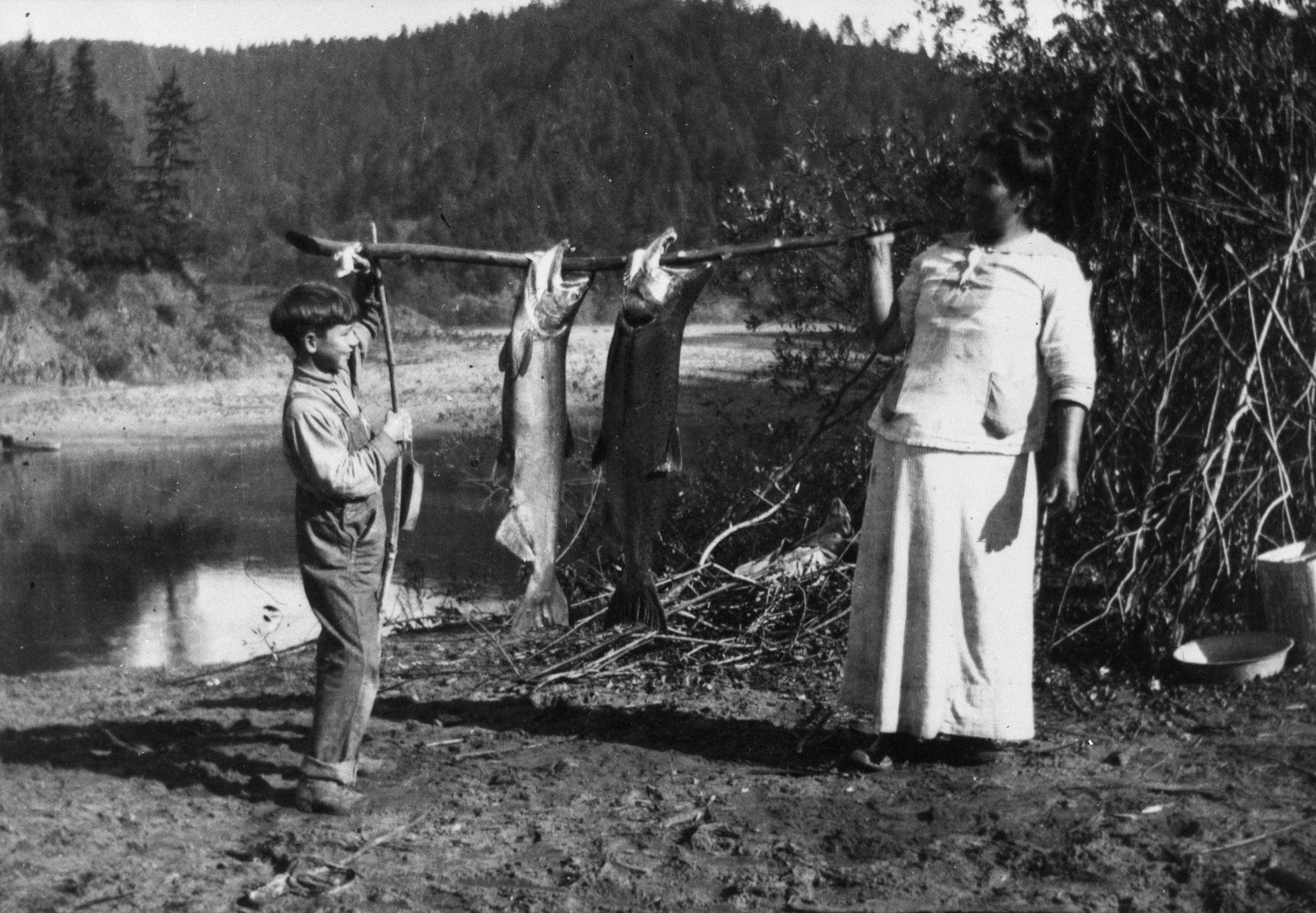
Tribes based along the Klamath River have depended on salmon for food and culture for thousands of years. The annual migration of salmon influenced nearly every aspect of Indigenous life. Photo courtesy of the Palmquist Collection, Cal Poly Humboldt Library Special Collections
Archaeologists digging in the Upper Klamath found salmon bones in places used by the tribes across thousands of years, but Cozzalio is quick to point out that those fish could have been acquired downstream and then carried upriver. One way archaeologists tested this possibility was to check whether the salmon skeletons they found included heads, because Indigenous fishers often remove salmons’ heads before transporting them. Since scientists found whole skeletons in the Upper Klamath, it supports the theory that the fish were caught there.
Cozzalio rebuts even this fine-grained point. He found a description, in the papers of an 1851 expedition into the Coast Ranges north of San Francisco, of how Indigenous communities air-dried salmon for storage. “All parts, even the head and spine, are preserved alike,” it reads. Cozzalio considers this proof that entire dried salmon, heads and all, were traded upstream. Yet the same document—one line earlier—says that Indigenous fishers did remove the spines. What it appears to add up to is that heads and spines were dried in the same manner as the flesh, but separately. Dried fish traded upstream would likely have lacked their spines and heads.
There are widely shared beliefs in Reservoir Reach that are easily proven wrong, some of them amplified by politicians in the area. I heard repeatedly, for example, that a rock “reef” historically blocked salmon from traveling upriver beyond the site of Copco No. 1 Dam. That rumor has honest roots in confusing wording in the 1976 book 50 Years on the Klamath, by John C. Boyle, engineer of the early dams. Nonetheless, a historical photo of the site where Copco No. 1 was later constructed shows a gorge without apparent barriers or waterfalls.
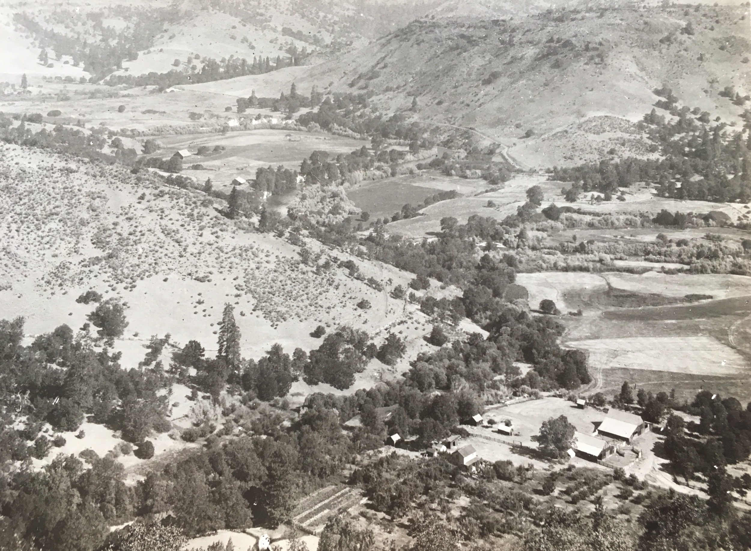
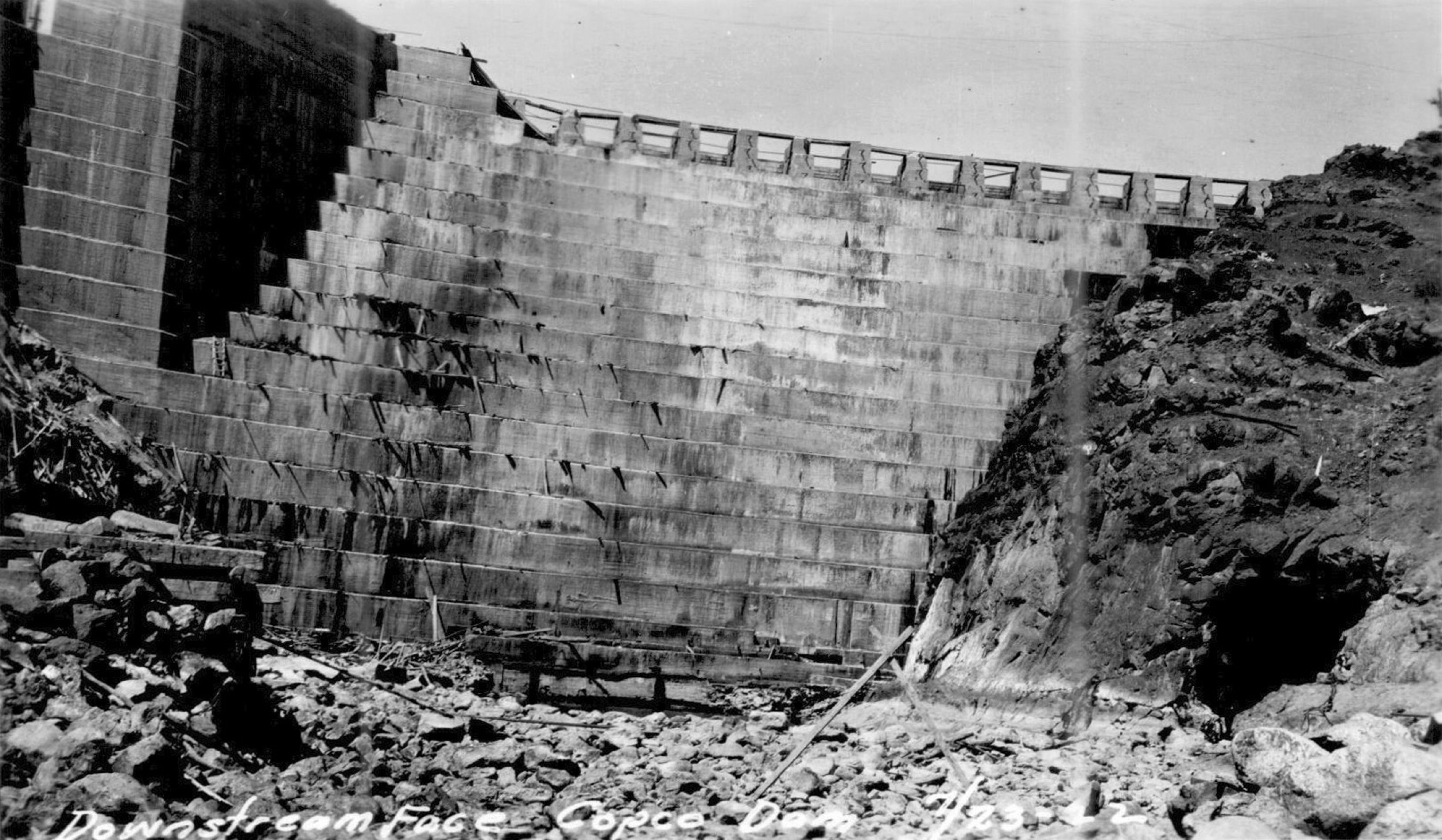
First photo: A 1910 image of the Copco No. 1 Dam site shows the farms and ranches flooded by the reservoir known as Copco Lake. Second photo: Construction of the Copco No. 1 Dam blocked the passage of salmon on the Klamath River in 1912. It’s shown here in 1922, the year it became operational. Photos courtesy of the Klamath River Renewal Corporation and the Klamath County Museum
Cozzalio’s argument is not so easily dismissed. There’s yet another twist: an overwhelming majority of the fish bones scientists found in the Upper Klamath came not from salmon but from suckers, fish that inhabit the Upper Klamath’s lakes and marshes. The best available explanation for both the scarcity of salmon bones and the fact that some historical documents fail to mention salmon in the Upper Klamath is that salmon have been periodically blocked from passing upriver. Indigenous stories recall long periods of hardship when downriver landslides cut short the fishes’ journey. (I witnessed one small slide off a slope that a local dryly described as a “self-mining mountain.”) Some small waterfalls, too, were difficult for fish to leap over when water levels were low.
Copco No. 1 Dam is stepped like a Mayan pyramid on its downstream face, which rises 38 meters. Video by Shane Anderson/Swiftwater Films
That seemingly robust finding puts opponents in a bind: they need an explanation for how officialdom could come to conclusions so contrary to their own. They find an answer in acute suspicion of any form of power that weighs against them. In Cozzalio’s view, both science and government agencies are corrupted in favor of elite, liberal environmentalism. He suspects that the Klamath Tribe’s remembrance of salmon “from time immemorial” springs instead from a present-day interest in acquiring land grants, funding, and control of Klamath water. He sums up dam removal as “a policy-directed, agenda-biased predetermination.”
It’s one of the most common claims I hear in Reservoir Reach: that the success of the dam-removal campaign was a back-room deal from the beginning—a rigged game. I soon learn that at least one back room really was involved. It was the Mount McLoughlin Room on the fourth floor of the Shilo Inn in Klamath Falls, Oregon.
Klamath Falls is a small city under big skies on Upper Klamath Lake.
3. The speed of trust
As the Klamath River flows, it’s about 100 kilometers upriver from Iron Gate Dam.
But by paved road, dodging snowstorms, it takes three hours through a black-and-white January landscape of barbed wire, abandoned barns, and snowed-over fields.
In the early 2000s, people on all sides of the Klamath River dam debates met in Klamath Falls—a town of about 22,000 people—to decide the river’s future. Photo by Prisma by Dukas Presseagentur GmbH/Alamy Stock Photo
The Shilo Inn turns out to be a timeworn highway-side hotel, and its McLoughlin Room is a typical meeting space with a mirrored wall etched with an image of leaping deer. In the early 2000s, clashing factions met here to discuss the fate of Klamath dams and water.
Jim Root rented the room on his own dime. Root, president of a multinational fruit processing business that popularized Fruit Roll-Ups, had started an organization called the Klamath Basin Rangeland Trust to advocate for water conservation among landowners. Then, during a drought in 2001, the federal government shut off almost all irrigation from the Klamath to save water for endangered suckers in the Upper Basin’s lakes and marshes and coho salmon downstream of the dams. The result was a rural uprising that threatened to turn violent against federal power and Indigenous support for the fish.
In 2003, Root invited deeply divided landowners, farmers, tribes, conservation groups, and federal bureaucrats to the McLoughlin Room for wide-open discussions. The only voices that Root excluded were those who, it seemed to him, had no interest in common ground and preferred “a world in which one side will win and the other will lose.” For example, he considered two organizations—WaterWatch of Oregon, on the conservation side, and Water for Life, on the side of agriculture—too litigious for the Shilo meetings.
“Early in those meetings a mantra came up for me: ‘We move at the speed of trust,’” Root says. In just seven months of meetings, friendships formed across the rifts to the point that, say, a conservationist might speak on behalf of farmers—their former antagonists—if a farming representative wasn’t able to attend a meeting, or vice versa.
Then the community newspaper got wind of what was happening, and the most entrenched defenders of irrigation rights began crashing the Shilo Inn, convinced they had sniffed out an archetypal back-room deal in the making.
“The protesters stopped the official meetings, but all of the relationships had been made and were durable and eventually came to fruition,” says Root. In 2010, after a further seven years of negotiations, more than 40 Klamath stakeholder groups signed a water-sharing agreement in the Upper Klamath that also created a potential path to dam removal in Reservoir Reach. It’s difficult to see how a hard-won, locally made compromise can be described as rigged from the start. That plan needed to be authorized in the US Congress, however, where it was torpedoed by Republican politicians. The win-lose mentality prevailed.
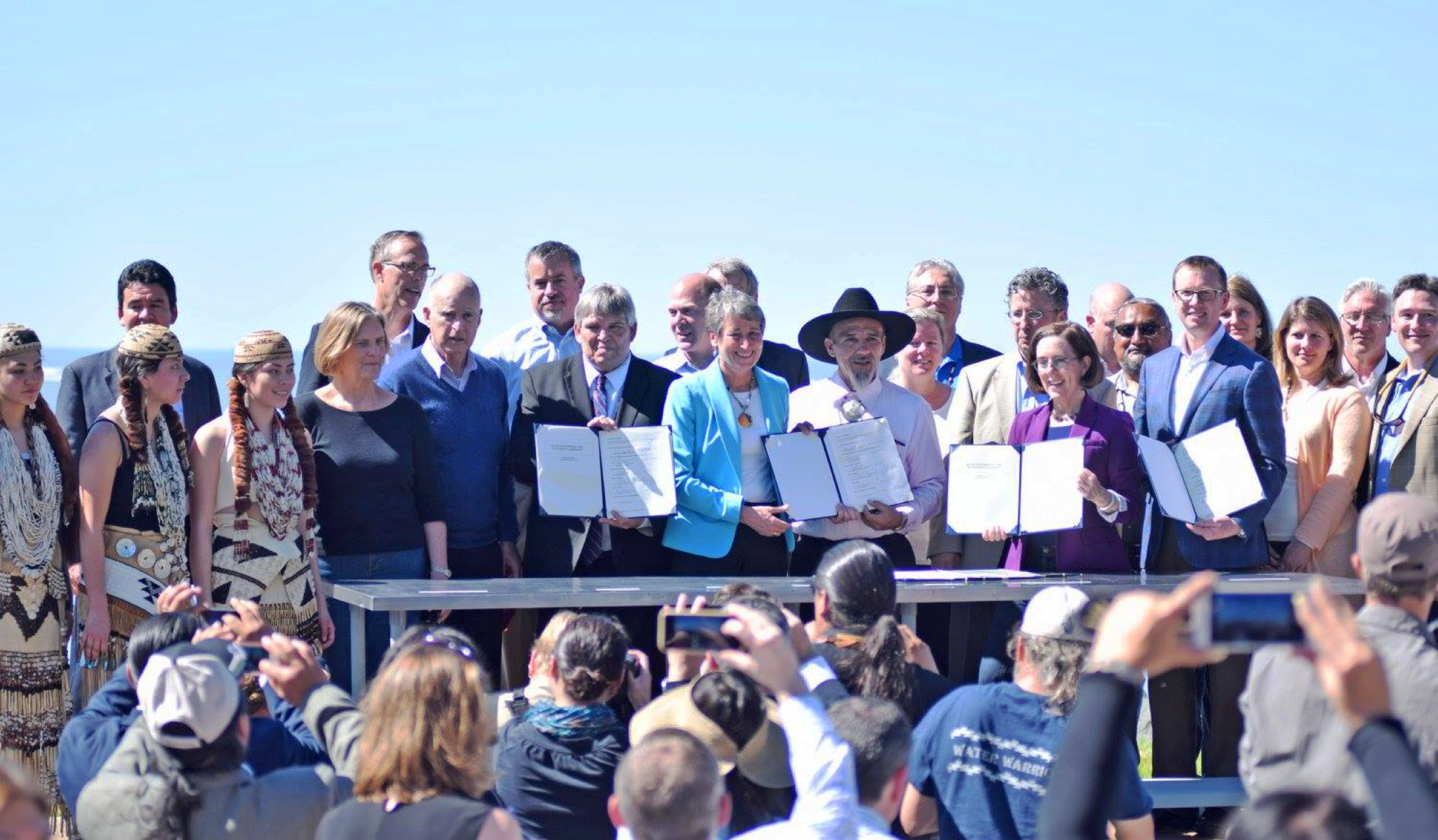
A multistakeholder water-sharing plan known as the Klamath Basin Restoration Agreement failed in the US Congress, but an amended agreement was signed on April 6, 2016, enabling dam removal to proceed. Photo courtesy of the Klamath River Renewal Corporation
By then, anyone looking to find a conspiracy had a more triggering figure to focus on: Warren Buffett, one of the richest people on Earth.
Before the water-sharing deal came together, supporters of dam removal had seen a potential opportunity in the fact that the dams’ operating license expired in 2006. At that point, the owner of the dams had two options. They could apply to have the license renewed by the Federal Energy Regulatory Commission, better known as FERC, or they could surrender the license and decommission the dams. The owner of the dams was PacifiCorp, but the owner of PacifiCorp was a faraway firm, Scottish Power.
“I thought we were going to win this in Scotland,” recalls Craig Tucker, a professional campaigner who works for the tribes that advocated for dam removal. In 2004, the Karuk Tribe—whose ancestral homeland begins roughly 90 river kilometers downstream of Reservoir Reach—made a trip across the Atlantic to let Scotland know that Scottish Power’s dams were hurting Native American tribes and salmon. “We were in Glasgow,” Tucker says, referring to the largest city in Scotland, “and the coat of arms had three salmon on it. They really identified as salmon people. They really identified as tribes or clans that had been colonized by the English.”
Returning home, the Karuk began working with Scottish Power shareholders to draft a resolution directing the company to surrender the Klamath dam license. Then, in May 2005, Tucker took a call while driving between Sacramento and Redding, California. Scottish Power had sold PacifiCorp to Berkshire Hathaway, Warren Buffett’s flagship company.
Conspiracy-minded critics see Buffett’s presence in the story as smoking-gun proof that Klamath dam removal is a priority for the politically liberal global elite, of which Buffett is undeniably a member. Through this lens, Buffett stepped in to make sure the dams come down. Tucker, though, remembers crying at the side of the I-5 highway after hearing the news. They were not tears of joy. By purchasing PacifiCorp, Buffett had nixed the shareholder resolution that could have led to dam removal. The tycoon, meanwhile, sounded dug-in on his purchase. “Our favorite holding is one that is forever,” Buffett told the press. “Utility assets fit the bill.”
Sixteen more years of activism followed, with victory snatched from the jaws of defeat again and again. The Yurok Tribe, whose homeland is a large region at the Klamath’s mouth, have been leaders throughout. When I tell Amy Bowers Cordalis, a member of the tribe who also acts as its lawyer, that some dam-removal opponents argue that the scales have always been tipped in her side’s favor, the outspoken activist is momentarily speechless.
“That just wasn’t the case,” she says at last. “We had to over and over again change the process, change the agreements. Nothing from our perspective was predetermined. We were up against everything: inertia, societal values, FERC precedent, equality—you know, all of it.” When Native American campaigners first raised the idea of fighting for dam removal, she says, government officials and PacifiCorp representatives laughed at the sheer audacity of the idea.
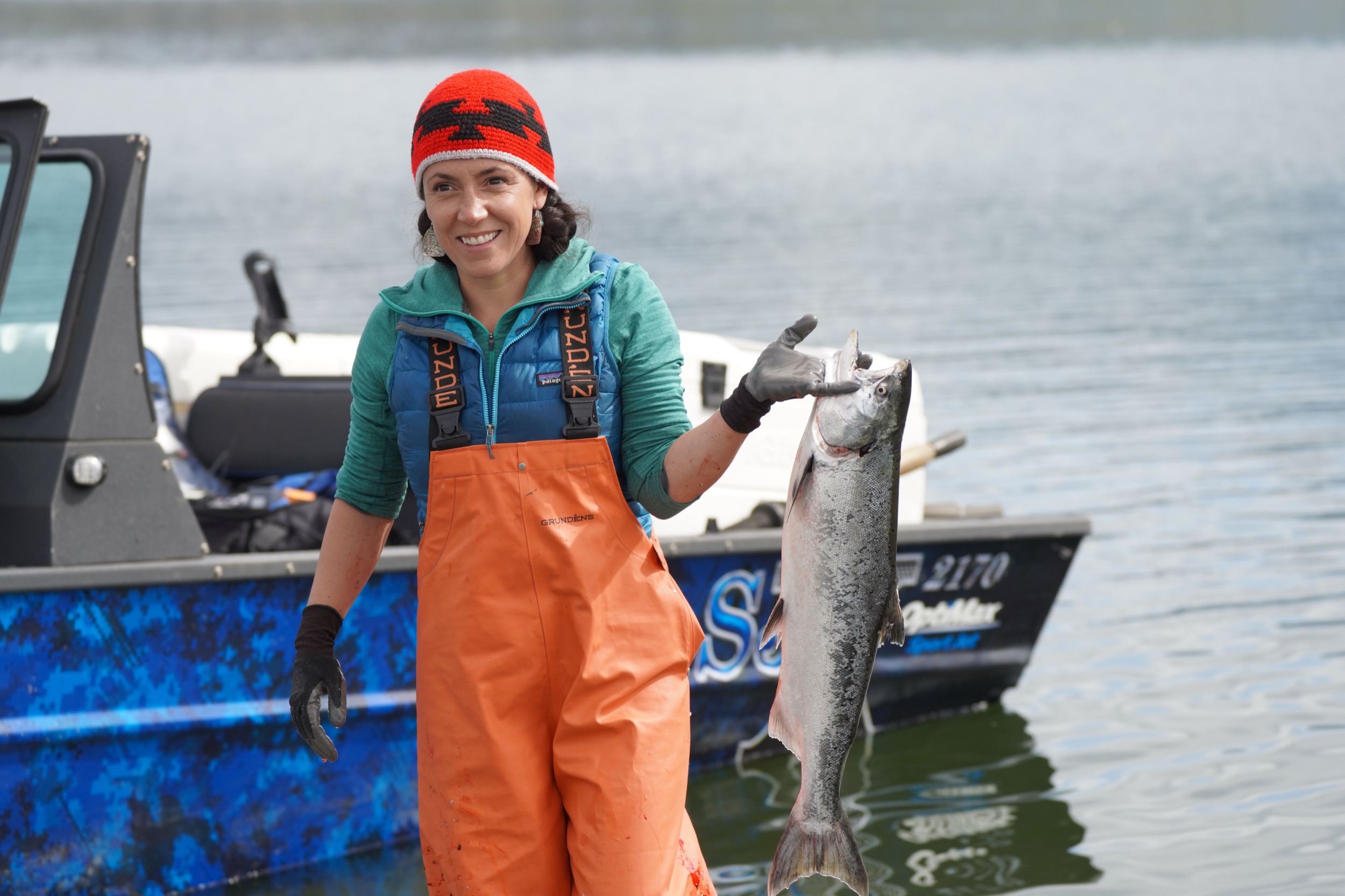
Amy Bowers Cordalis—a member of the Yurok Tribe who serves as the community’s lawyer—fishes for salmon in the Klamath River. Photo courtesy of the Yurok Tribe
Along the two-decade timeline, Bowers Cordalis particularly remembers a final crisis in July 2020. It struck while she was relaxing poolside at her sister’s house in Ashland, Oregon. By that point, the dam-removal campaign’s victories had convinced Berkshire Hathaway and PacifiCorp that relicensing the dams would involve costly upgrades to allow fish to pass the barriers, as well as financial uncertainty into the future. They’d agreed to transfer the dams to KRRC, which would then surrender the operating license and pay for dam removal. It seemed to be a done deal. The states of California and Oregon had signed on, and even the Trump administration had signaled that it would not stand in the way. Then Bowers Cordalis’s phone started buzzing.
FERC had ruled that KRRC could not take possession of the dams without PacifiCorp staying on the license as a financial backstop. This was a deal-breaker for PacifiCorp, which was then prepared to walk away. A doomsday clock began counting down: proponents had 90 days to find a new way forward, or dam removal seemed bound—for the umpteenth time—for failure.
“There is a universe where the dams could have been operational,” Bowers Cordalis assures me. Instead, a final agreement was negotiated: the states of California and Oregon would join PacifiCorp to create a contingency fund against cost overruns as the dams were removed, easing the financial risk for the company. With that, in 2021, dam removal was given the go-ahead.
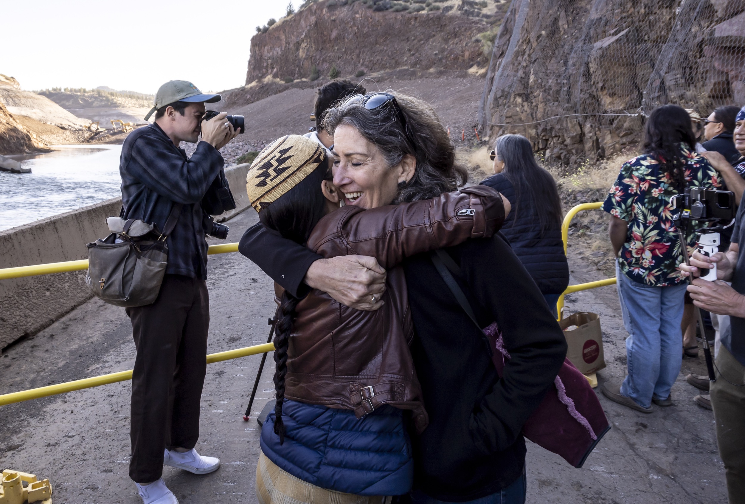
Amy Bowers Cordalis hugs Laura Harnish, an environmental planner, as construction crews remove the final barriers of Iron Gate Dam on August 28, 2024, allowing the Klamath River to flow freely there for the first time in a century. Photo by Carlos Avila Gonzalez/San Francisco Chronicle via Getty Images
Standing in front of Iron Gate Dam on that January day when its lower tunnel was opened to drain the reservoir, I asked Tucker when he first felt confident that this moment would finally come. “Oh, about nine o’clock this morning,” he said. From a conspiracy-theory perspective, in which the fix was in for dam removal from the start, his words could only be explained in one of two ways. Either he never realized that he was little more than a marionette for shadowy puppet masters, or he was on the inside of the scam and telling a bald-faced lie. To distort others’ essential humanity in this way demands an act of unseeing—a refusal to see others as you would hope to be seen yourself.
Of course, in the rabbit-hole way of these things, unseeing is often practiced by those who feel unseen.
I have appointments in Copco Lake, but three days have passed since Iron Gate Reservoir began draining, and I want to check on it first.
Before drawdown began, I had built a cairn of rocks at the water’s edge in a place called Mirror Cove, like a kid at the seashore pushing a stick in the sand to know when the tide is retreating.
I might as well not have bothered: the cove is empty. The whole reservoir, which before seemed unnaturally still, now trembles—the river asleep in its depths is stirring.
4. A different kind of truth
Iron Gate Reservoir, filled in the early 1960s, was drained of its 66 million tonnes of water in early 2024. What emerged was a new landscape of sediment and aquatic plants and a reborn Klamath River. Photo courtesy of Swiftwater Films
Driving up the shoreline, I see that gardens of aquatic plants now dry in the sun, exposed. A creek that used to flow into the artificial lake now tumbles in as a waterfall. At the head of the reservoir, there’s no longer a reservoir. It’s a reborn bend of the Klamath River.
From there, Copco Lake is only a short drive away, but dam-removal operations have closed the rough dirt track. Instead, I retrace my route, then follow backroads through hills east of the Klamath valley, playing peekaboo with Mount Shasta, the volcano that dominates the southern horizon like a giant, misplaced iceberg. An hour later, I reach my destination.
My main meeting in the hamlet, with a group of four residents, is not a welcoming one. “Why are you here?” asks Mike Stear, who manages a PacifiCorp cattle ranch on land upriver. I think he is asking this: where were you, Mr. Journalist, during the years when the community was fighting against dam removal? Why turn up now, with Iron Gate unplugged and just days to go before Copco’s reservoir—Copco Lake—is drained? “For me, at this point, it’s kind of like when somebody dies,” Stear says. “I’ve already mourned the loss of this lake.”
His words make sense of the feeling in the room. It has the same quiet anguish, the same minefield of emotions, as a gathering at a funeral home. Stear is already missing the reservoir. Geneve Harder, seated to his right, feels that removing the Copco dams dishonors farmers and ranchers like her grandfather and his brother, who gave up their land for flooding and moved upriver; she says we’re turning back the clock of progress. Linda Spannaus, whose grandfather was that other brother, is feeling for the countless frogs, waterfowl, turtles, fish, and other animals that will lose their homes or die as the century-old lake becomes a river again. She foresees the deaths of beloved trees at the water’s edge that will soon be on high, dry land.
Residents of Reservoir Reach live in a landscape profoundly changed by industrialization, but so do almost all of us.
The response I’m seeing on the shore of the Copco reservoir is the one so many are having as hurricanes strike where they never have before, where ancient trees are dying for lack of rain.
“Solastalgia”: the distress of seeing familiar landscapes turn unfamiliar.
“Eco-grief”: the despair of losing what you care for in the natural world—even if what you now mourn is itself the outcome of a past assault on the original landscape.
Pioneer-era farming equipment, found buried in the bed of the now-drained Copco Lake reservoir, hearkens back to a time before the river valley was first flooded. Photo by Jason Hartwick/Swiftwater Films
Chrissie Ishida Reynolds, a second-generation resident, pauses the conversation. She wants to read aloud a statement that she has prepared. It begins pointedly.
“Another reporter,” she says, “wants to come and ask us how we feel about dam removal and the impacts to our lives. Another opportunity to dredge up toxic feelings of anger, despair, inequality, and every other negative emotion to fill the gullet of the latest vultures who want to feed on the carrion, the blood and guts of the roadkill.”
How would I feel, Reynolds demands. How would I feel if my parents or grandparents had made their lives on the shore of Copco Lake, and I had grown up swimming in it, boating on it, eating line-caught fish at the end of the day?
Then her tone begins to shift. What is happening to the residents of Copco Lake is not an isolated incident, she says. It involves global forces that are coming for nearly every one of us, and whatever is precious to me could be “the next target for elimination.” Not long afterward, she mentions a United Nations document called Agenda 21. It’s not the first time I’ve heard about it in Reservoir Reach.
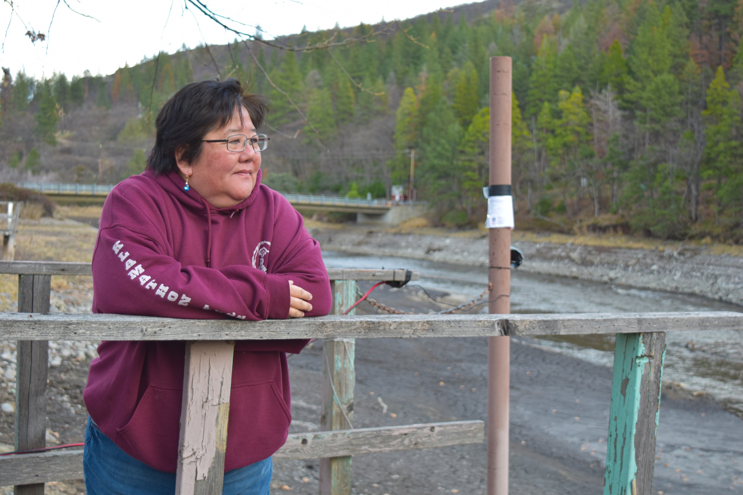
Copco Lake resident Chrissie Reynolds looks out over the mud flats after the reservoir was drained. Photo by Juliet Grable/Jefferson Public Radio
Agenda 21 is a “program of action” signed in 1992 by leaders of nations representing 98 percent of the world population; then-president George H. W. Bush, a Republican, put down his signature on behalf of the United States. The agenda lays out principles for a more coordinated response to global environmental and developmental challenges. It is non-binding and has no enforcement mechanism—no teeth—whatsoever.
Still, opponents of Agenda 21 sprang up in America as soon as the ink was dry, arguing that it represents a blueprint for green tyranny, or even a Hunger Games–like plot to reduce the human population and secure resources for the elites. Some opponents of dam removal grafted that suspicion onto their cause. Ten years ago, the Southern Poverty Law Center, which monitors America’s far–right wing, identified a handful of “players” pushing the Agenda 21 conspiracy. One, Kirk MacKenzie, was based in Siskiyou County.
Assign a media fact-checking team to determine whether Agenda 21 poses a fundamental risk to human rights and freedoms, and they would report back with a single word: FALSE. Letter-of-the-law veracity isn’t everything, however. There’s also the question of whether an allegation has the ring of truth, and to whose ears.
Suspicions about outside forces have deep roots in Reservoir Reach. Ironically, the first of those outsiders were the pioneers who came searching for gold, timber, and ranchland; the people who justifiably didn’t trust them were the Indigenous nations who had lived there for millennia.
That Indigenous presence was so strong that one US Army officer stationed in the area in 1854 wrote, “If any country in the world has ever merited the title of Indian Country, this is it”; he described the white settlers as “squatters.” But resentments were rising among these newcomers, too. It was also 1854 when John Wool, commander of the army’s Pacific Department—essentially an occupying power—spoke out against the settlers for their “lawless barbarity practiced upon tribes of Indians of the most inoffensive nature.” Wool even sought reinforcements to protect the tribes. Among myriad crimes, a gang of white settlers scalped and murdered, in that order, a leader of the Shasta people, whose name is recorded only as Chief Bill; he was being accompanied by an army officer and carrying a written guarantee of safe passage. With dam removal, the Shasta Indian Nation will finally reclaim the heart of their homeland.
In the early 20th century, the California Oregon Power Company began planning dams on the Klamath. The engineer John C. Boyle recounts in 50 Years on the Klamath that surveyors first visited the Copco No. 1 site in 1910. They found a grassy basin with “beautiful farms” scattered along a deep, slow-flowing river.
“The people who lived on their farms were very reluctant to sell even though the prices offered were somewhat high,” Boyle writes. He adds—possibly as a gloss in his own favor—that most of them ultimately accepted that hydroelectricity was progress. At least one did not. Kitty Ward, a Shasta, refused to move, saying she preferred to drown as the reservoir filled. In the end, her ranch foreman persuaded her to travel to Hornbrook, her home was flooded, and she died of a stroke soon after.
Slide the arrow to the left to see how the construction of John C. Boyle Dam flooded the landscape, shown here in 1953 (first photo) and in 2022. Satellite images courtesy of USGS and Esri
By 1924, many Northern Californians were ready to support more dams on the Klamath—and again the question was decided by outsiders. With two dams proposed for the lower river, a state-wide referendum on whether to turn the Klamath downstream of Hornbrook into a conservation preserve divided largely along north–south lines. A state senator representing three counties in the Klamath watershed called the dam ban “industrial and economic strangulation.” The California fish and game commissioner mocked him in the Los Angeles Times as “a statesman from the redwoods.” The proposal to protect the lower Klamath from dams passed overwhelmingly, and damming on the Klamath was limited to Reservoir Reach.
In the 1940s, frustrated northern politicians put forward the idea of a new US state, to be called Jefferson, made up of parts of Northern California and southern Oregon. Their “state seal” featured two black Xs to symbolize that the region had been double-crossed, giving up its timber, ore, and cattle to urban Americans who then disdained the people who produced them. “The State of Jefferson is the natural division geographically, topographically, and emotionally,” said one early secessionist leader. “In many ways it is a world unto itself.” That movement faded during the Second World War, but resurged in 2013, again out of rural resentments. One of the deepest was the legacy of the northern spotted owl.
In 1990, the spotted owl was dwindling across the Pacific Northwest. Under the Endangered Species Act, the federal government restricted logging on a patchwork of nearly 30,000 square kilometers of forests—enough land to create a State of Spotted Owl larger than Massachusetts. Officials assured communities like Hornbrook that displaced forestry workers would be retrained and asked them to trust the science showing that their plan would save the owl. Neither promise came true.
A 2021 study by researchers from the National Center for Environmental Economics and the University of Chicago’s Harris School of Public Policy found that between 16,000 and 32,000 timber jobs had disappeared—fewer than the timber industry predicted but still a lot of empty lunch pails. Nearly one in 10 related businesses, such as sawmills, shut down. The losses went above and beyond changes in the timber industry due to automation and shifting market conditions, and the researchers found no evidence that the government plan to retrain workers “played an important role” in alleviating unemployment.
The spotted owl was not saved. According to the National Wildlife Research Center, their numbers have declined by more than one-third since the last fragments of their forest habitat were set aside. Protecting the birds from logging did help, but the spotted owl ended up facing off—and losing—against a competitor, the barred owl, a species formerly restricted to eastern forests that has been expanding westward.
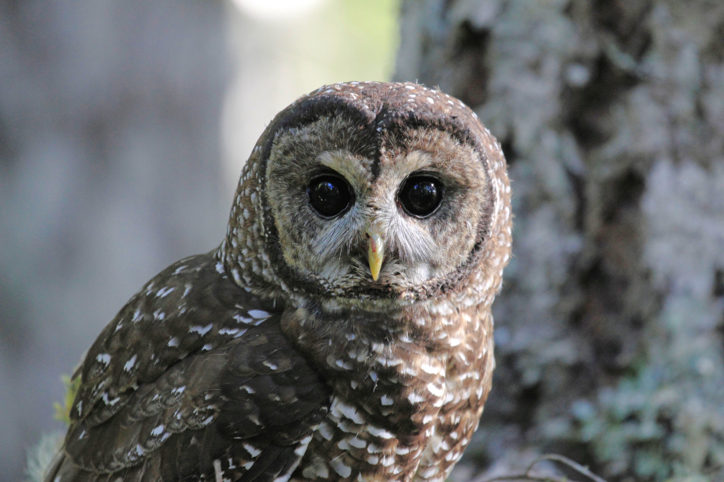
In rural California and Oregon, failed plans to save the northern spotted owl have resulted in job losses and distrust of conservationists, scientists, and the government. Photo by Rob Nagel Photography/Alamy Stock Photo
The residents of Reservoir Reach I speak to often hold up this history as evidence that they can’t trust advocates of dam removal. Many suspect connivance between scientists, conservationists, politicians, and even corporations to harm local interests.
One night in Hornbrook’s First and Last Chance Saloon, an enrolled member of the Karuk Tribe tells me that the Klamathon Fire—a wildfire that burned the Hornbrook area for 183 days, destroying more than 80 homes and structures—was an act of what he called “forced climate change”: deliberate forest mismanagement designed to cause fires that create an illusion of climate change, which in turn provides a pretext to depopulate the region. Betty Miller, owner of the popular bar, says that many of her customers suspect that dam removal is a step toward protecting the area as a national monument, again to drive residents out. In Copco Lake, Chrissie Ishida Reynolds fights back tears as she says, correctly, that draining the reservoirs will nearly wipe out lake species like sunfish and catfish, meaning that residents will no longer be able to angle for fish that have no daily catch limit. To her, it’s evidence of how plutocrats, applying schemes like Agenda 21, are snatching away freedoms in Siskiyou County.
Let me say frankly that I don’t find these connect-the-dots theories credible. They aren’t detached from reality, though. They’re attached to the reality that, for more than a century, people here have felt subject to outside forces beyond their control that ignore or devalue their interests. Through that lens, seeing a sinister role for global illuminati doesn’t take a long leap of imagination.
Reynolds is first to leave the Copco Lake gathering, and no one in the group that remains—Stear, Harder, and Spannaus—echoes her comments about Agenda 21. As the meeting winds down, the mood seems lighter, and I read this, perhaps as a gloss in my own favor, as catharsis. Harder offers to take me upstream to see riverside pioneer homes weathering between canyon walls. Klamath Canyon has been floated as a name for the community once Copco Lake no longer stands on a lake.
Driving back into the town, we pass the turnoff to the community’s lone store, belonging to Francis Gill, who at the time was the fire chief, and his husband Danny Fontaine, then the assistant fire chief. I’d met Gill there just after pulling into town. “There are times when you think, holy crap, we’ve only got a week and a half left and all this will be gone,” Gill had said. The lake is already lower than usual, ready to take in the water from the John C. Boyle reservoir upstream, which is next in line to be emptied.
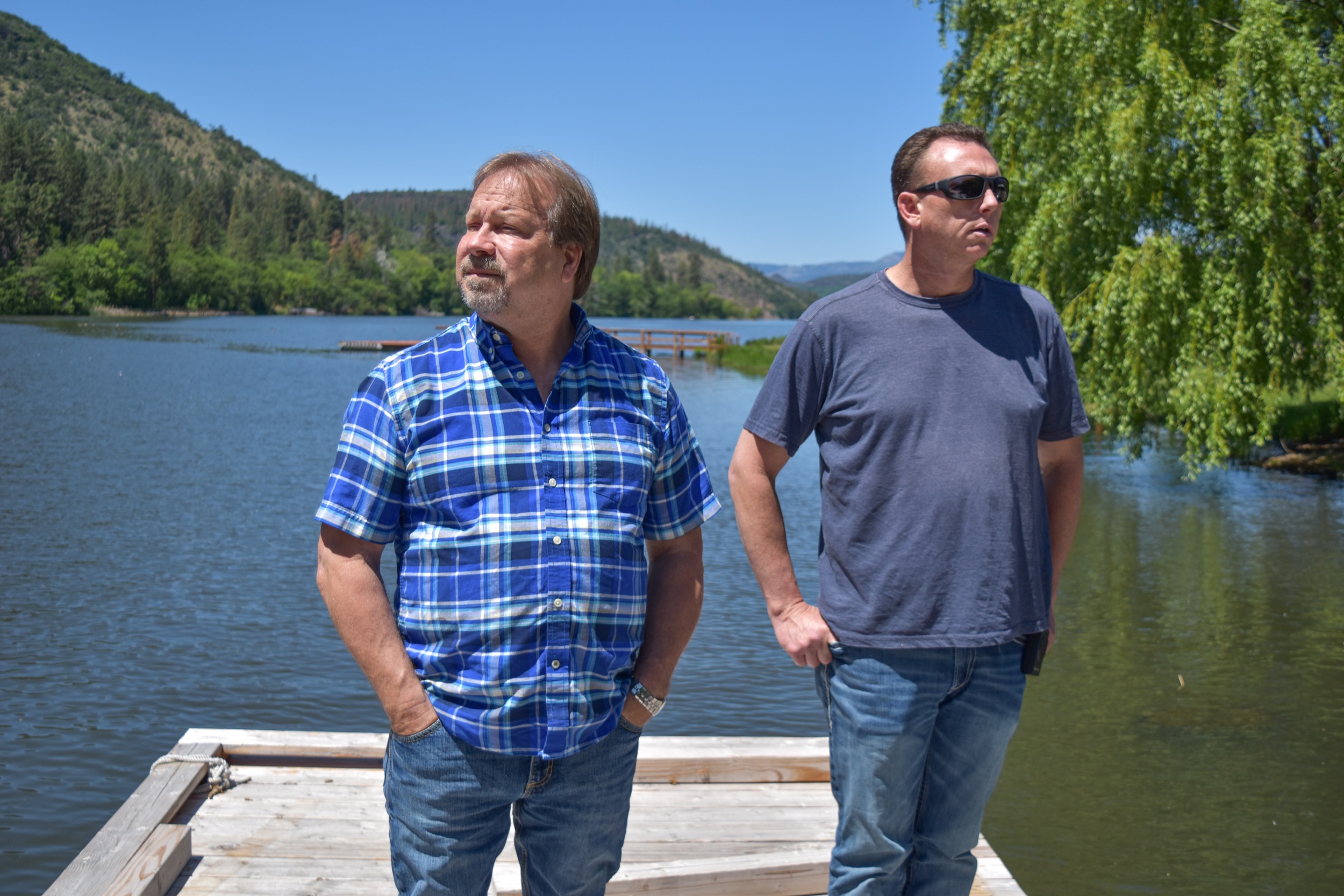
Danny Fontaine (left) and Francis Gill stand in front of Copco Lake in 2023 before the reservoir is drained. Photo by Juliet Grable/Jefferson Public Radio
Gill, a resident since 2002, stands out for having invited the KRRC and RES to hold public meetings at Copco Lake. They’d held the final gathering a week and a half earlier. Twenty people showed up, he said, and the questions were mainly practical ones about the coming changes. Most of Gill’s own concerns have been satisfied. He knows that the dams were never designed to offer flood control—a legendary 1964 flood took place with all the dams firmly in place. He knows that the river downstream is unlikely to run dry once the dams are gone, because of minimum-flow requirements from the dams that will remain. He worries about how wildfire crews will fight fires in the area without huge reservoirs of water to draw on, but also knows that the California Department of Forestry and Fire Protection has signed off on dam removal.
“There were still some people pushing the conspiracy-theory end of things,” Gill told me, recalling the meeting. He’s a well-informed resident who worked hard to get the best available information, and I asked him what, after all of that, he now made of the conspiracy-theory end of things. He paused.
“Honestly, sometimes it feels that way,” he said at last. “Like they just want us all out of here.”
On January 23, 2024, a three-and-a-half-meter tunnel at the base of Copco No. 1 Dam is blasted open with dynamite, initiating the drawdown of Copco Lake prior to dam removal. Press play and turn on your sound to see and hear the explosion. Video by Shane Anderson/Swiftwater Films
Named after the chief engineer of the California Oregon Power Company, John C. Boyle Dam went online in 1958 to produce hydroelectric power for the Klamath River region. Video by Pond5
According to Dan Petersen, a project manager with the Kiewit engineering firm, the detonation that will open up a tunnel in John C. Boyle will be 20 times more powerful than a typical construction-site blast. For safety’s sake, the visiting observers are herded into a former storehouse to watch the explosion on-screen.
We hear a five-minute warning. A one-minute warning. Finally: “Zero minutes to blast”—and the whole building judders, followed instantly by a boom like a too-close thunderclap. A wild, almost ululating cheer rises from the crowd, and, on the screen, water pours out of the dam. Then people pour out of the building to witness it in real life.
Some instinct makes me hang back, and when the warehouse is nearly empty, I see that a fistful of men has not joined the stampede. At the center of the group is Pete Sukraw.
I had talked to Sukraw, director of Klamath River operations for PacifiCorp, the previous night at the Shilo Inn. Sitting in the near-silent lobby, he told me he was born and raised in Klamath Falls and now lives an hour and a half away in Medford, Oregon. He’s worked on the dams since 2006, and I asked him how he had adapted to the idea of dam removal. He replied that he had not adapted to it. In his opinion, the dams should have continued to operate, with measures taken to help salmon travel upriver. He mentioned that some of the employees’ fathers had also worked on the dams; Sukraw’s uncle did, too. I asked if dam operators develop the kind of relationship with dams where they see them almost as living things, each with its unique personality, the way sailors might with ships they crew on. “They do,” he replied. His favorite dam was John C. Boyle.
Now John C. Boyle Dam is no longer holding water; no longer, really, a dam. The dam keepers have, in a sense, just sailed their own vessel to the shipbreaker’s boneyard. Sukraw’s face seems to say, It is what it is. The expressions of the other PacifiCorp workers range from choked up to darkly angry, and I find myself holding two realities in mind that seem hardly able, these days, to share the same space. The first is that the dams have amounted to an ongoing assault on Indigenous communities and rights, and on the many fish that move between fresh water and the sea; removing the barriers will right historical wrongs. The second is that the identities of many people here—their memories, ways of life, worldviews, sense of purpose, idea of home—are bound up in the dammed landscape and even the dams themselves.
Might this be an important challenge of our times? To hold in mind this kind of dissonance, not only here but everywhere that the oil field, the coal mine, the mill turning ancient trees into lumber—the systems that made the world as we know it—are giving way to shifting values and necessities? Can we still move at the speed of trust, or does the urgency of our crises condemn us to ignore it?
Then I follow everyone else’s wet bootprints outside. On my first visit to John C. Boyle a month and a half earlier, I had seen the Klamath below the dam as little more than a trickle between boulders green with algae. Now I post-hole through the fallen snow to an overlook into that canyon.
Someone has built a small pedestal of ice against a chain-link fence. Stepping onto it, I suddenly see the Klamath, rushing and rolling down its gorge, its waters freed to flow, very soon, unbroken to the sea. We humans make things so complicated. But in that moment, it feels only right to root for the river.
Video: The Klamath River rushes through the gates of John C. Boyle Dam after the reservoir drawdown process begins in early 2024. Photo: The Klamath River flows free after John C. Boyle Dam is removed in 2024. Video and photo courtesy of Swiftwater Films
The twists and turns underlying the question of how far upriver salmon swam—and many similar questions adhering to the dam removal project— help explain how locals in Reservoir Reach can decide that the facts may favor their side.
It’s also why scientists have pursued the truth across decades. It’s why dam removal has been tested in approximately 75 governmental permit, authorization, or approval processes, as well as several court cases.
On the issue of whether salmon once spawned in the Upper Klamath, they concluded that the fish most likely did and will do so again.
Edited by Jude Isabella and Sarah Gilman. Designed and produced by Serena Renner, Jeremy Latham, and Mark Garrison, with support from Chris Drake Kristina Blanchflower, and Tyee Bridge. Fact-checking by Amy van den Berg. Copyediting by Rowena Rae. Proofreading by Ruth Wilson.
Photo of Chrissie Reynolds from the article “Residents shocked and saddened by loss of Copco Lake amid Klamath dam removal” and photo of Danny Fontaine and Francis Gill from the article “Paradise lost? Copco Lake residents brace for dam removal” by Juliet Grable from the series “After the Dams: Restoring the Klamath,” originally published on ijpr.org on February 3, 2024 and June 18, 2023 respectively. Copyright 2023 and 2024 Jefferson Public Radio. Used with permission. Any unauthorized use or duplication is strictly prohibited.